HCM City – Da Nang – 11 Day Loop

HCM City – Da Nang – 11 Day Loop

Route Summary

Duration: 3 days - 2,425 kms

While this is 11 ride days, it is for sure a two week experience enjoying the best of the South / Central areas. This ride takes in all of the best coastral rides in the country going North and the diversity of the remote mountain areas back South. Two weeks you will never forget!

Click for Route details:

Day 1: Cat Lai Ferry - Vung Tau via Lakes - 155 kms

Cat Lai Ferry - Vung Tau via Lakes

Distance: 155 kms

This is by far the best way I’ve been to avoid the traffic getting out North of the city and my favourite way to Vung Tau also. The police are rather active in the first 10 km or so from the ferry so watch your speed in that area.

Once you’re on the North side of the highway the roads open up and you can get a little more liberal with the throttle.

You’ll pass under the expressway and that’s my indicator that the fun is about to get real.

From there its diverse farmland and rubber plantations most of the way to the coast. Plenty of great deviations off this map so if you have time follow it loosely and enjoy some exploring. Many of the trails aren’t on maps but it doesn’t matter you’ll pick it up again later.

(A) gets you around the first and usually the only police stop and a bowl of Pho if you missed breakfast. Some other good food options once you get over the highway.

(B & C) are a couple cafes as pins to keep you on the most interesting route past two lakes. 

(D) is another lake and a good lunch option keeping you on the right track through some rubber to the next lake. Careful ordering the portions very generous. 

(E) Takes you around another lake and a good spot to throw a line for a half distance break. From here plenty of exploring off map to be done if time allows. Corn, banana, pepper, lots of sweet potato and cassava all grown in this area. 

(F) is a memorial cross in memory of the 18 Australian and 245 Vietnamese soldiers killed In the August 1966 Battle of Long Tan.

(G) gets you down to the ocean for a coastal ride into Vung Tau. If short on time you can drop (G) at the Long Tan Cross for the more direct run in through Ba Ria.

(G & H) take you into Vung Tau along the newly developed back beach. 

(I) The Twisted Throttle Tavern awaits for an icy cold beer or great pub food. 

Log in below to view full route maps, accommodation and food information.
These are supplied to all our touring bike customers.
(Excluded from the above itinerary) 
Day 2: Vung Tau - Mui Ne - 195 kms

Vung Tau - Mui Ne via Coast

Distance: 195 kms

Day one out of Vung Tau is just so much nicer than out of Ho Chi Minh City. We start off along the coast rather than having to battle the city traffic.

(A & B) get you the best way out.
(C & D) take you for a look through an interesting fishing village.

(E) Is a great beach front coffee stop.

We hug the coast though as times move away from it through farmland to our next rest stop.

(F) At 64 metres high and built by the French in 1899 the oldest and highest lighthouse in Vietnam. A good stop to have a walk and check out the area.

(G) Is a point off the best beach stretch and an area known for its sunsets over the water.

As is evident to anyone riding the “esplanade” beach access in MuiNe is very limited. In fact it’s easy to forget you’re in a beach town through much of it at all.

If planning some time here a beachfront resort out of the accommodation options is worth considering particularly if with family.

(H) The town is well positioned as a good stopover though and this hotel is clean, great staff, very reasonably priced and has a good pool though the bar we normally use for a few beers on arrival is street front.

Plenty of great lunch and dinner options a short walk make it a great choice I now use often.

(I) Another great option off the beach at the higher end. Great unique cabins with a natural pool and great restaurant / party area.

Log in below to view full route maps, accommodation and food information.
These are supplied to all our touring bike customers.
(Excluded from the above itinerary) 
Day 3: Mui Ne - Sorrento Beach Club - 170 kms

Mui Ne - Sorrento Beach Club

Distance: 170 kms

Although MuiNe has some great hotels and restaurants, for a coastal town its easy to go away disappointed. Almost all beach views are built out right through town. 

Early on this ride though you realise you don’t have to be far out of town for some lovely and mostly unoccupied coastal beauty. The good news is a wonderful diversity of coastline is yet to come. 

(A) This area has big dunes where you can hire quad bikes or four wheel drives to explore them. Its a lot of fun but barter on price. The fee is at times elevated to the unwary tourist.

(B) One of a few small fishing villages you’ll pass for the day.

(C) Another great coastal photo stop. There are many over the day so even though its a short ride distance wise its easy to fill the day in exploring. 

Even when we are forced to endure a short stretch on the main road there is still some camera candy. Watch your speed on the main road. The police are active especially around the power station.

(D & E) This capeland area is one of my favourite coastal rides in the country. Use the parking bays to safely take the sights in. Cattle and goats are often roaming this area so you need to stay focused when on the bike. 

(G) The second salt farm area for the day.

(H) Our preferred accommodation in this area is one of my favourites in the country. If you can’t have fun here you’re not trying. 

Log in below to view full route maps, accommodation and food information.
These are supplied to all our touring bike customers.
(Excluded from the above itinerary) 
Day 4: Sorrento Beach Club - Whale Island - 275 kms

Sorrento Beach Club - Whale Island

Distance: 275 kms

The dawn is always out the front over the water and a good place to enjoy it from. An early swim, an early start on the bike or a relaxing breakfast from 7.30am all great options here.

If the weather is right there’s lots to see today and the coast ride at dawn is stunning if you’re up for it.

Some great photo opportunities including a quaint fishing village in a protected bay. I’ve marked numerous on the map but often through here now I’m so into the ride I bypass most. For safety use the well located parking bays. Tour buses frequent the area these days.

(A-D) on the map are great photo stops but plenty on offer.

(E) over the bridge to get you off the highway.

(F) is a great stop. Good food option right on the sand if you missed breakfast. The burgers are exceptional.

(G) is a good little pub run by Andy and Van if it’s getting around lunch time.

(H) you could give a miss if time is stretched but worth the diversion if not. Alternatively some great accommodation down there if you want to pull up short.

(I) I love this peaceful bay and the sister restaurant also pretty good though by road better to it than the rocky path if coming home in the dark after a few beverages:) Great fishing spot if you’re like me and take a pack rod.

Log in below to view full route maps, accommodation and food information.
These are supplied to all our touring bike customers.
(Excluded from the above itinerary) 
Day 5: Whale Island - Quy Nhon - 185 kms

Whale Island - Quy Nhon

Distance: 185 kms

The coast ride today has some pleasant sections with exceptional coastal views but also some unavoidable stretches on the A1 so you need to be mindful of heavy vehicles on those sections. Not a big day distance wise and due to the higher speeds on the highway sections you’ll cover the distance easily so plenty of time to enjoy the stops and lunch. Some of the country’s most picturesque coastline so take your time. 

(A) don’t miss this. Well worth the short detour and walk out to the lighthouse. Take water, it’s further than you think.

(B) is this very nicely constructed monument on the beach.

(C) is my recommendation for lunch if fresh seafood appeals to you. Many restaurants are on the water and haven’t found a bad one yet.

(D) Plenty of great coastline and farmland to enjoy. At the top ladies selling souvenirs, snacks and drinks. A favourite early ride of mine for a Cafe Sua Da.

(E to F) Vietnam’s longest wooden bridge. I’ve been over it many times but its condition varies. Won’t be for everyone and there will be a small fee at the other end. Easy to go around the road if you opt out.

(G & H) are two of the many hotels and food options attached.

Log in below to view full route maps, accommodation and food information.
These are supplied to all our touring bike customers.
(Excluded from the above itinerary) 
Day 6: Quy Nhon - My Khe (Coastal) - 230 kms

Quy Nhon - My Khe (Coastal)

Distance: 230 kms

My habit in this beautiful coastal paradise is always up and to the beach at dawn and rarely disappointed. Then off to the coffee and a Banh Mi across the road from the Quy Nhon Sports Bar.

From the bridge and the view back to the city it feels like you’re going to an island but it is connected.

(A) You can spend an hour just exploring around this area alone.

At 230 km this is an easy day but I strongly recommend getting away early. So many coastal nooks to explore.

The map pins (B-F) are some of the many interesting stops over the day.

(G) Is this rugged coastline. Great spot to break the pack rod out.

If on XR’s plenty of beach runs. Easy to get on but at times hard to get off. Most a bit soft for the big bangers.

No shortage of interesting local seafood offerings, cheap as chips.

I’ve pinned a rather nice Quang Ngai accommodation option or across this new bridge to your My Khe Beach destination.

Lots of seafood restaurants along the beach road but as good and cheap at the hotel and the beer is cold.

Sunset over the river and dawn at the beach again. It’s a hard life! 😋

Log in below to view full route maps, accommodation and food information.
These are supplied to all our touring bike customers.
(Excluded from the above itinerary) 
Day 7: Da Nang - Mang Den - 270 kms

Da Nang - Mang Den

Distance: 270 kms

Starting from our Danang location this day is make up of two very different halves. The first half of the day is exploring the coast, staying off the main arterials as much as practical. The second half we go inland to riders heaven. The last stretch of this day as good as motorcycling gets. 

Out over the rivers South of Hoi An and the the traffic thins for a relaxed transit section. 

(A) A very well developed entertainment complex. A must if taking a child pillion as I often like to do. 

(B) If only for a coffee this beachside cafe bar is worth dropping into. The Monster Burger as good as I’ve ever had anywhere. 

(C & D) Are beachside view points to keep you off the main road. Nothing special there but far better than playing with trucks, buses and police. 

From the time we move away from the coast the second half of this ride is exceptional. Not only for the riding but the interesting countryside. 

(E, F & G) The best of many viewpoints up through this pass looking over the valley. (G) A very special area rarely ridden other than locals on scooters moving produce. 

The ride from the top of the pass to your night stop is the best hard top in the country for high capacity bikes particularly. Taking a break from that to go exploring off map can also be very rewarding in this remote bushland. 

(H) My favourite accommodation in Mang Den, formally the Dak Long commune. A very interesting village and another place to enjoy the dawn around the Dak Ke Lake if you’re up for it. 

(I) A nice little waterfall that only adds 8 km if you haven’t had enough exploring.  

Log in below to view full route maps, accommodation and food information.
These are supplied to all our touring bike customers.
(Excluded from the above itinerary) 
Day 8: Mang Den - Buon Ma Thuot - 325 kms

Mang Den - Buon Ma Thuot

Distance: 325 kms

Mang Den is one of my get up early and enjoy the dawn places. There’s some great walks but around Dak Ke Lake is one of the best if you like playing with cameras. 

Whilst distance wise this is a big day, time wise with a reasonably early start you’ll do it easy. Most of the day is quite remote with very little traffic and comparatively less photo stops. 

Early on there’s a village on your left. Turning off the map and exploring out the other side of the village is a lot of fun but with the new awesome road now I usually stick at it these days. 

After the right turn at the cross road watch for cattle on the road for the first few kilometres. Thereafter you have two hours of motorcycling bliss.

(A & B) Are my preferred coffee and food stops. Around (B) theres plenty of options.

Between (B & C) is mostly farmland but in recent years like many other areas around the country has been littered with wind farms.

There’s an unavoidable stretch on the main road. When on that keep your speed in check. There’s always police presence there.

(D & E) Are very cool coffee stops though which take you on an alternative route to miss most of it.

(F,G & H) Once into town are the town monument, a good value hotel and an interesting afternoon or night spot if with a group of thirsty lads. 

Buon Ma Thuot, is the capital and economic hub of the Dak Lak Province. With a population of around 440,000 its the largest city in the Central Highlands and prides itself with a coffee culture. The city is tidy and the people for a big city ooze a country town hospitality attitude. 

Log in below to view full route maps, accommodation and food information.
These are supplied to all our touring bike customers.
(Excluded from the above itinerary) 
Day 9: Buon Ma Thuot - Gia Nghia - 230kms

Buon Ma Thuot - Gia Nghia

Distance: 231 kms

This is an area largely overlooked by westerners and tourists in general. Like a lot of the far North West, we get some funny looks here. Like all remote areas though, the country people are so friendly and hospitable.

The higher country in the South is largely overlooked because the South has by far the best coast rides. This in a multi day loop adds to a sensational and very diverse experience.

(A &B) These waterfalls are the smaller of the two in this river area. Well worth the 30km diversion in wet season though. You might choose to drop them in the dry season. 

(C) Don’t miss this waterfall though. Only a short diversion and has coffee and food if you choose to get away early and make it the breakfast stop. 

(D) Plenty of accommodation and restaurants around this the most populated of the four lakes for the day. Elephant rides around this lake area also if interested. 

(E) A hydro dam wall retaining the third of todays lakes. Its around a 12km diversion so if time is your friend especially if you travel with a drone.

(H) The biggest lake by far for today. This natural lake covers over 80 hectares and and is surrounded with an abundance of flora and fauna. A place the nature lover could spend days to explore.

(I) A very unique accommodation with a number of options. My first night here a very memorable night with some great mates many years ago so became a favourite in the area. 

Log in below to view full route maps, accommodation and food information.
These are supplied to all our touring bike customers.
(Excluded from the above itinerary) 
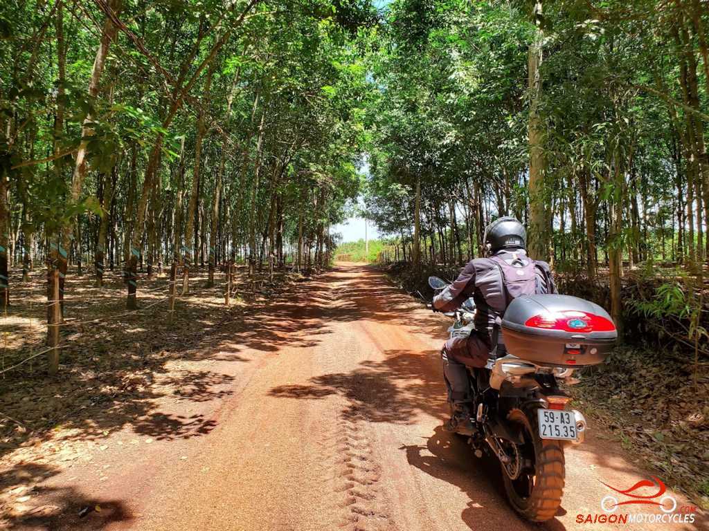
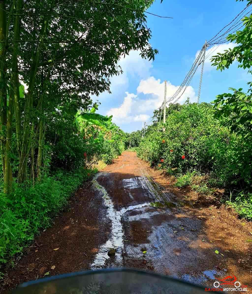
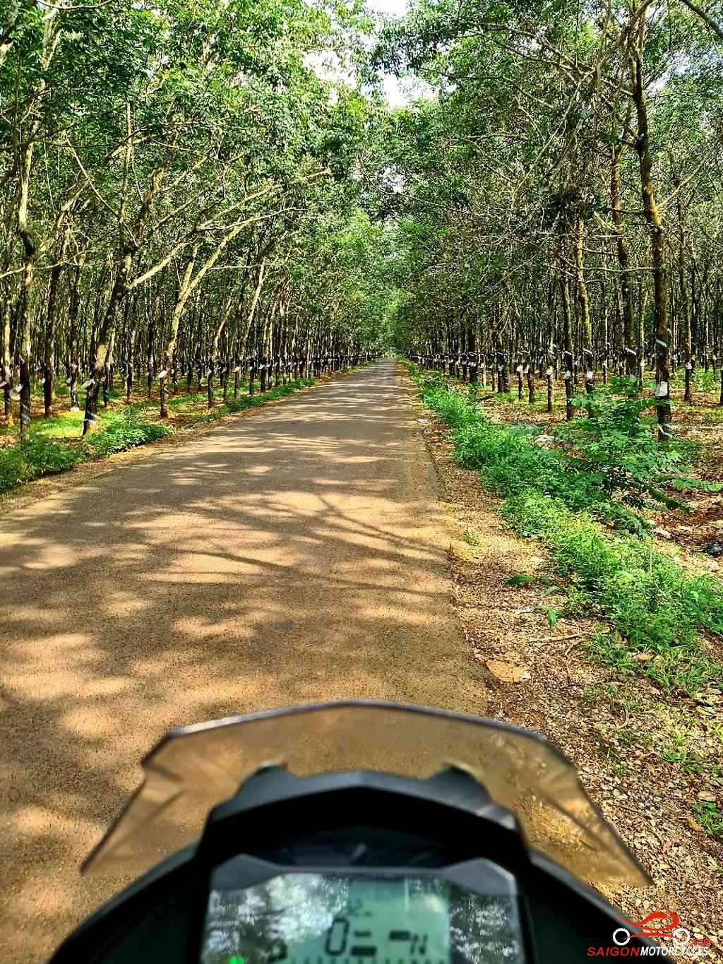
Day 10: Gia Nghia – Cat Tien - 230 kms

Gia Nghia - Cat Tien

Distance: 230 kms

This isn’t a big day distance wise but you can easily take all day getting it done. The river, lake and waterfall views are a stand out day in the South.  

Your destination, the Cat Tien National Park covers an area of 750 km² in the provinces of Dong Nai, Bình Phuoc and Lam Dong and preserves one of the largest areas of lowland tropical forests left in Vietnam. Easy to spend some time there if natural beauty in peace and quiet appeals as a nice change of pace.  
 
 (A) The first of three waterfalls today. As this photo shows its not much in dry season so could be one to leave out. Worth the short detour in wet season though. 

(B) Ta Dung National Park previously a Nature Reserve covers 220 km². At its heart a hydro dam that created a massive lakes system with 40 islands and peninsulas in the Dong Nai River system. Don’t miss this short detour for some great view points. 

A good coffee stop or brunch maybe if you skipped breakfast. Plenty of good local food options in this area. 

(C) A big wide bridge, well located for a break and a photo opportunity with your trusty steed.

(D) Dambri Falls. Its 200k admission per person so not everyone opts in. It’s a nicely set up attraction though with a toboggan ride, cinema, cafes. This gets very busy with locals in holiday times so better to avoid that.

(F) A good viewpoint for a break 

(G) This sturdy suspension bridge is the best option into your night stop to avoid the main road. There is a river crossing option but you really need to know how to take that on. 

(H) To one of our preferred accommodation options in the village. There hasn’t been too much on offer here historically but there’s plenty of choice now so worth a hotels search for a bargain. 

Log in below to view full route maps, accommodation and food information.
These are supplied to all our touring bike customers.
(Excluded from the above itinerary) 
Day 11: Cat Tien - HCM City via river - 160 kms

Cat Tien - Cat Lai Ferry

Distance: 160 Kms

The first part of the run to the big smoke around the lake area is the best of it. The waterpark is worth a look and a quick dip. From there it’s back to reality the best way possible in the wet season. Works in the dry too but i have options for that.   

(A & B) a lake dam wall. Nice and very different views on each side.  

(C) a waterpark with falls. I’ve been in for a look but don’t use it. A swim stop or a great option travelling with kids. For the purpose of this a pin to keep you off the highway.  

We stick to back roads where possible, all sealed. You may question some of the route but it’s mapped to minimise police presence, trucks and buses. Three short stretches are unavoidable.   

Plenty of off roads too if you have time and want to follow this loosely.  

(D, E & F) are coffee stops again primarily pinned to keep the ride interesting and safe. (E) and particularly (F) the better ones.  

(G) the ferry where the Rat Race awaits. If returning with a hire bike refueling on the way to the shop would be very much appreciated. Don’t worry about cleaning, we have that covered.  

Log in below to view full route maps, accommodation and food information.
These are supplied to all our touring bike customers.
(Excluded from the above itinerary) 

Log in below to view full route maps, accommodation and food information.
These are supplied to all our touring bike customers and excluded from the above itinerary.

Shopping Cart
Scroll to Top

Donation Form

Every donation helps. Whether large or small, 100% of your donation will be sent to aid disaster relief for Central Vietnam flooding.
Thank you.

[wcdp_donation_form id="164971"]

Yohe Helmet Giveaway!

Offer valid until end 08/25 

10% off All Helmets
For Students!

20% sale on other selected helmets
Receive a free
Balaclava and JoBoy Sunglasses
with any helmet valued over 3 mill vnd.
Offer available from 1/8/25 – 28/8/25

FREE OIL CHANGE on Saturday 5th April

  • Do you love your bike?
  • Do you tour or ride more than 1,000 kms a month?
  • Is you bike 2018 model or later?

If the answer is “Yes” and you ride one of the listed models, you qualify for a free, high quality oil change from Anglomoil. Click the button below and if your bike is listed, come and see us for a FREE oil change!